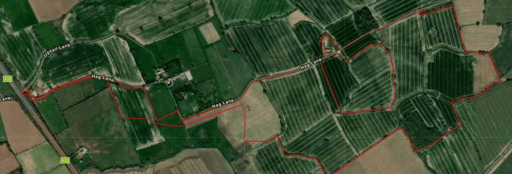
Above: NatPower’s map of the entire 173-acre site. The red outline shows the full extent of it.
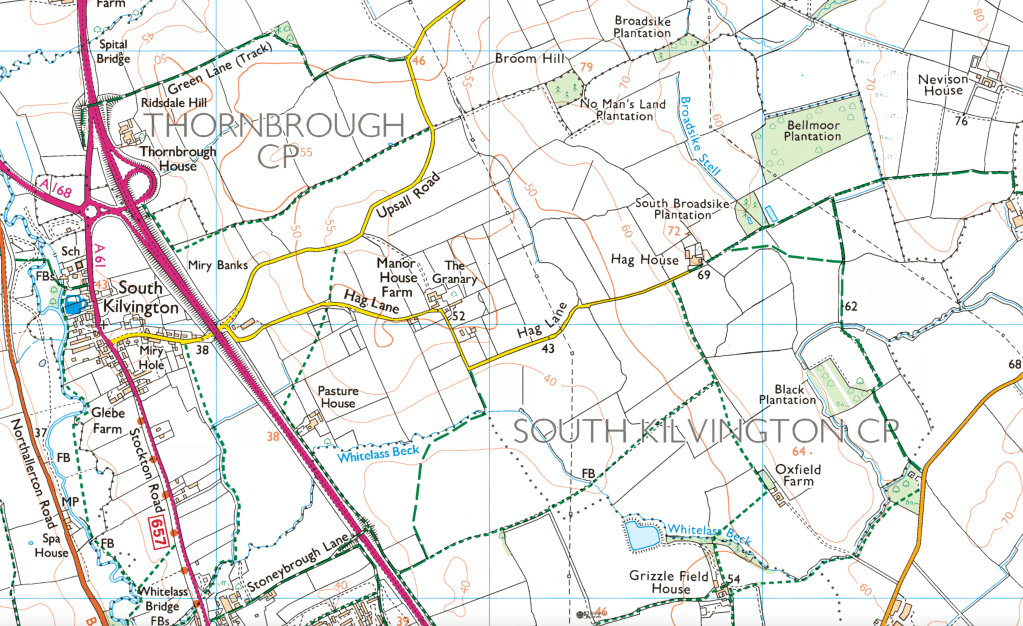
Below: An Ordnance Survey map showing roughly the same area, but also revealing how close the development will be to South Kilvington and north-east Thirsk (Stoneybrough Lane).
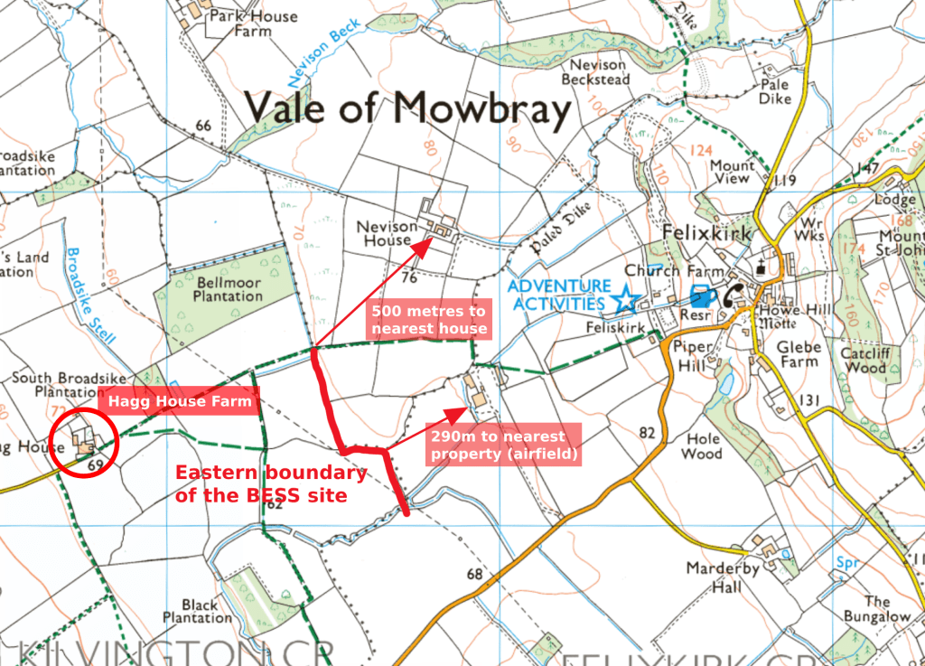
Below: An Ordnance Survey map annotated to show the western boundary of the BESS site, including distances to nearby properties.
Hagg House Farm appears to be included within the BESS site.
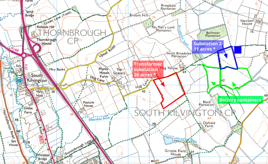
Below: An Ordnance Survey map annotated to show the sites of the transmission and transformer substations, and the battery containers.